geodeform
Software suite for transforming seismic image data, including transcribing axes and units, accurately warping from time-scale to physical depth based on strata, and more.
Contact to discuss binaries or source.
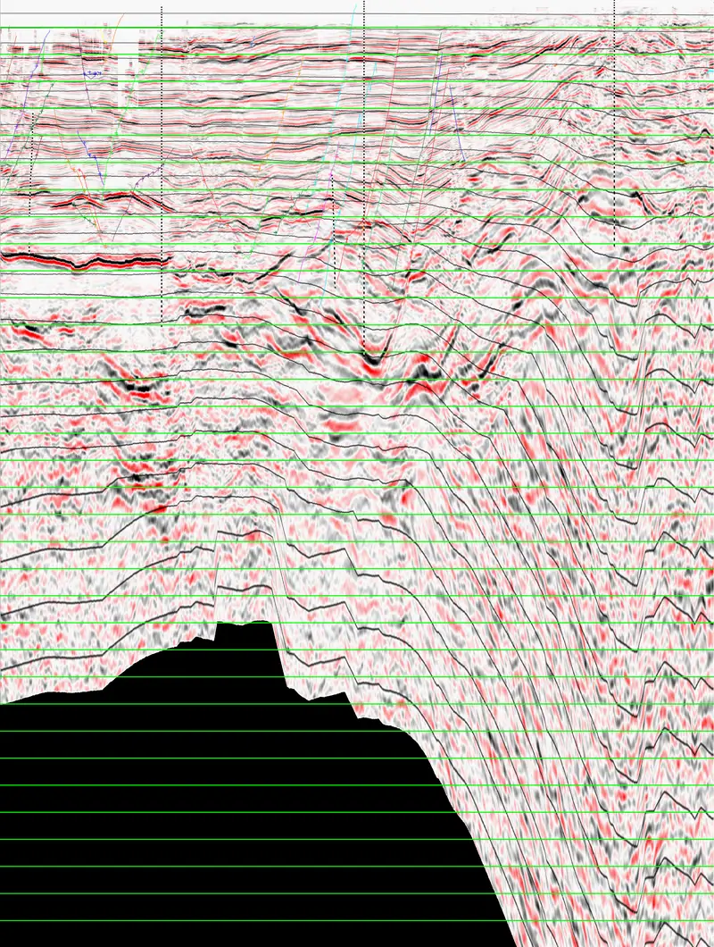
Software suite for transforming seismic image data, including transcribing axes and units, accurately warping from time-scale to physical depth based on strata, and more.
Contact to discuss binaries or source.